Articles · Village history
Enclosure in north Hampshire villages: open fields, awards and maps
In brief
- Much of north Hampshire's hedged, straight-edged field pattern was created by enclosure, mostly between about 1750 and 1850.
- The general Acts of 1801, 1836 and 1845 standardised and then centralised the process, which affects where the records are kept.
- An enclosure award records new roads, allotments to each owner and fencing duties; its map is keyed to the award.
- Cottagers without a legal common right could lose grazing and fuel; the local effect needs the documents to judge.
- We have not confirmed enclosure dates for North Waltham, Steventon, Ashe or Deane; Tate's Domesday, Hampshire Archives and The National Archives are the places to check.
Contents
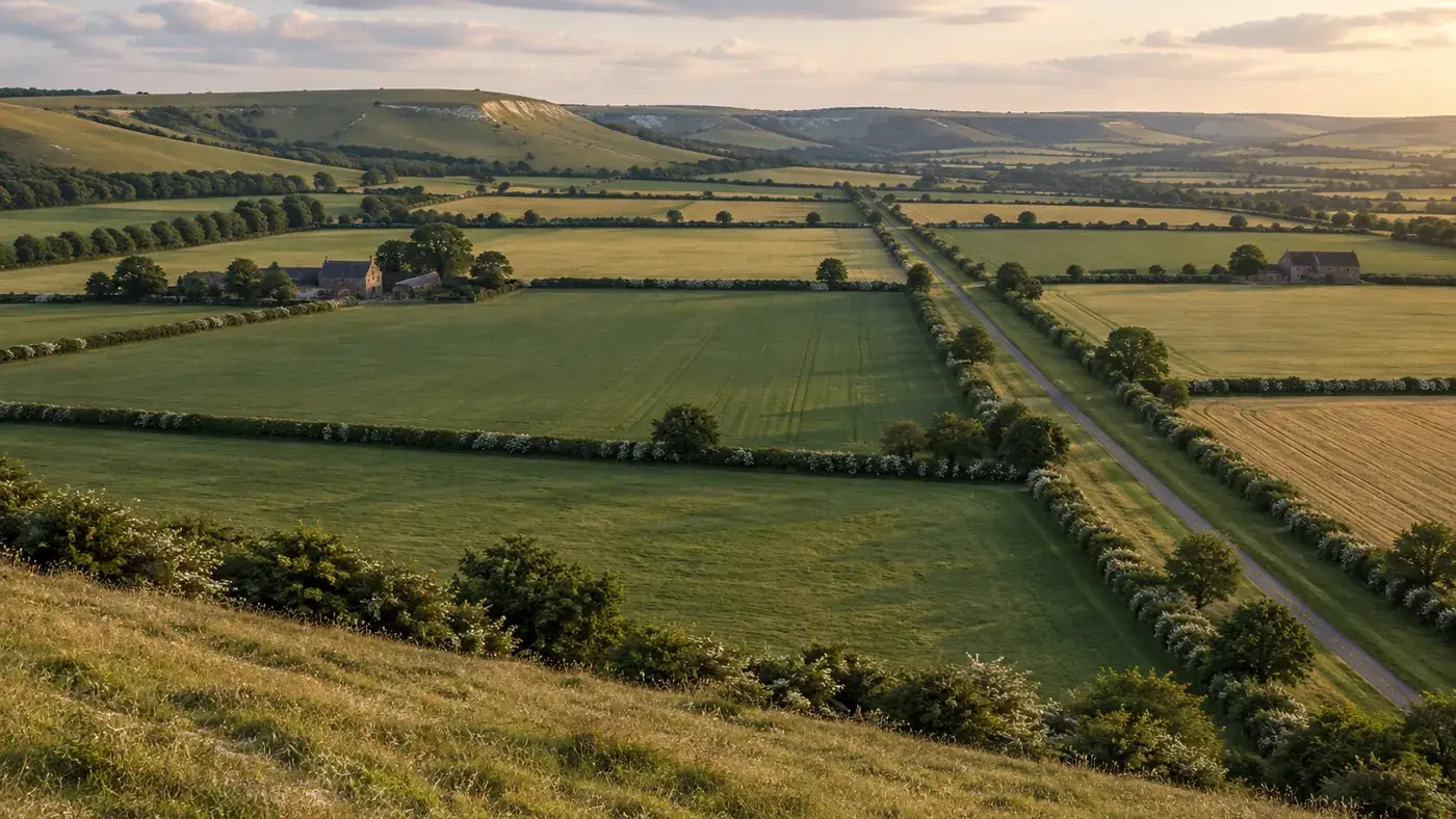
Walk the lanes between North Waltham and Steventon and most of what you see looks settled and old: hedged fields of a fair size, a few straight roads running across the downland, small copses at the corners of fields. Much of that pattern is younger than the parish churches by many centuries. A great deal of it was laid out on paper by enclosure commissioners, then planted and fenced by the owners who received the land. This article explains what enclosure was, how it worked in law, what records it left behind, and how to find out whether and when our four parishes were enclosed. On that last point we have to be honest at the start: the society never published a full account of enclosure in North Waltham, Steventon, Ashe or Deane, and we have not yet confirmed the dates from the original documents. What follows tells you where to look.
Open fields and commons before enclosure
For much of the medieval and early modern period, many villages on the Hampshire chalk farmed at least part of their land in common. The arable lay in a small number of large open fields, divided into long narrow strips. A farmer held strips scattered across each field rather than one compact block, so that good and poor ground was shared out. After harvest, and in the fallow year, livestock grazed the stubble in common. Beyond the arable lay the downs and commons, where tenants with the right to do so turned out sheep and cattle, and cottagers might gather furze or fuel.
The system was never uniform. Some Hampshire parishes had been partly enclosed by private agreement long before Parliament became involved, often when a single landowner held most of the parish and could simply reorganise his own estate. Small parishes where most of the land belonged to one or two owners are exactly the kind of place where open fields could disappear quietly with no Act at all, and Ashe and Deane are both small parishes, so the possibility needs checking before anyone looks for an Act. That is one reason not to assume that every parish had a parliamentary enclosure.
Words you will meet
- Common field or open field: a large unhedged arable field divided into strips.
- Furlong or shot: a block of strips running the same way within a field.
- Common of pasture: the right to graze a stated number of animals on common land, often tied to a particular holding.
- Allotment: in an enclosure award, the parcel of land given to a person in exchange for their former strips and rights. It does not mean a vegetable plot, although some awards did set aside land for the poor.
Parliamentary enclosure, mainly 1750 to 1850
From the middle of the eighteenth century, landowners who wanted to enclose but could not get every interested party to agree turned to Parliament. A private Act named commissioners, usually three or so local men of standing with a surveyor working for them, and gave them power to survey the parish, hear claims, extinguish common rights and redistribute the land in compact blocks. Most such Acts were passed between about 1750 and 1850, with a heavy concentration during the French wars, when high grain prices made conversion of downland and common to arable especially attractive.
Each private Act was expensive, and the costs fell on the landowners receiving allotments. Parliament gradually tried to standardise and cheapen the process. Three general Acts matter most for anyone reading local records.
| Act | What it did | Why it matters to researchers |
|---|---|---|
| Inclosure (Consolidation) Act 1801 | Set out standard clauses for commissioners, surveys and claims, which later private Acts could adopt rather than spelling them out each time. | Private Acts after 1801 tend to be shorter and refer back to it, so you may need both texts to understand a local Act. |
| Inclosure Act 1836 | Allowed open arable, meadow and pasture fields to be enclosed without a private Act if two thirds of the interested owners, by number and by value, consented in writing. | Enclosures under this Act may leave no Act of Parliament naming the parish, only an agreement and an award. |
| Inclosure Act 1845 | Created the Inclosure Commissioners for England and Wales, a standing body that could approve schemes centrally, with provision for allotments for exercise and recreation and for the labouring poor. | Later awards are often found among the central government records at The National Archives as well as locally. |
The pace slowed sharply after the 1840s. By the later nineteenth century public opinion had turned towards protecting commons rather than dividing them, and the Commons Act 1876 made enclosure harder to justify.
What an enclosure award and map contain
The award is the commissioners' final, legally binding document. It can run to dozens of pages of close handwriting. Most awards follow a recognisable order:
- A preamble reciting the Act, the names of the commissioners and surveyor, and the date of their first meeting.
- A description of the boundaries of the land being enclosed.
- Public roads and private roads, with their widths, routes and who was to maintain them.
- Public watering places, gravel or chalk pits, and land set aside for the poor or for recreation, where there was any.
- Allotments to the tithe owner, if tithes were being extinguished in exchange for land, and to the lord of the manor for his manorial rights over the waste.
- Allotments to each proprietor in turn, with the acreage, boundaries and a number keyed to the map.
- Instructions about fencing: which side of each allotment was to be hedged or ditched, by whom, and by when.
- Exchanges of old enclosed land between owners, made at the same time for convenience.
The map shows the new allotments, each numbered and often with the owner's name written in. Some maps also show the old strips or furlong names, which is gold dust for anyone interested in the earlier landscape. Many do not. The map is usually more legible than the award, but the award is the legal text, and where they disagree the award normally governs.
If you have used the tithe map for a parish, an enclosure map will feel familiar. The two are often confused, and they are different things made for different reasons. Our pages on reading a tithe map and on the Steventon tithe map explain the tithe side. As a rough guide, if a parish was enclosed before about 1840, the tithe map will show the enclosed landscape that the award created, and comparing the two can show how far the new fields had been subdivided or merged in the meantime.
Effects on cottagers and on the landscape
The effects of enclosure have been argued over by historians for more than a century, and the answer depends heavily on the parish. Owners of land and of recognised common rights received allotments in proportion to what they had held. The difficulty lay with people whose use of the commons rested on custom rather than on a legal title: a cottager who had kept a cow or geese on the waste for years without a formal right might receive nothing. Small proprietors who did receive land could find the cost of their share of the commissioners' fees, plus the fencing they were required to put up, more than the allotment was worth to them, and some sold out. Against that, more ground came under the plough, and hedging and road-making gave work for a time.
What we cannot tell you, from the records we have checked so far, is how any of this played out in our own villages. That would need the award, the land tax returns before and after, and ideally the poor law records, read together.
Reading enclosure in the landscape
Parliamentary enclosure left a distinctive look on the ground, and once you know the signs you will see them across north Hampshire:
- Fields with ruler-straight boundaries meeting at regular angles, quite unlike the curving edges of older closes near a village centre.
- Hedges dominated by hawthorn, the standard quickset planting of the period, with fewer species than an ancient hedge.
- Roads running dead straight between wide verges, because the award fixed their width, often at forty feet or more between the hedges, far wider than the carriageway needed.
- Isolated farmhouses out among their fields, built after enclosure when a farmer's land was no longer scattered around the village.
- Small rectangular plots beside roads, sometimes a former gravel or chalk pit allotted for road repair.
None of these features proves enclosure on its own. Straight boundaries can come from later estate reorganisation or from twentieth-century field amalgamation. Treat them as reasons to go and look at the documents, not as answers. The page on the farming year on chalk downland gives some context on how this land was worked once it had been enclosed.
How to find out whether and when our parishes were enclosed
The answer for each of our four parishes is waiting in the archives rather than in our files. This is the order in which we would look.
Start with the published finding aids
The standard national list is W. E. Tate's A Domesday of English Enclosure Acts and Awards, edited by M. E. Turner and published by the University of Reading in 1978. It lists Acts and awards county by county, with dates and the repository holding each award where known. Reference libraries and the larger record offices have copies. If a parish does not appear, that is a strong hint that any enclosure was by private agreement or happened before the parliamentary period, though omissions do occur.
Hampshire Archives and Local Studies
Hampshire Archives in Winchester holds the county's copies of many enclosure awards and maps, together with estate papers, manorial records and quarter sessions material. Search the online catalogue for each parish name together with "inclosure" and "enclosure", because both spellings are used, and also try the names of the main landowning families. If nothing turns up under the parish, ask the staff: awards are sometimes catalogued under a neighbouring parish, or within a family collection rather than a public series.
The National Archives
Awards made under the general Acts, particularly after 1845, often have copies among the records of the central commissioners and their successors at The National Archives, in the MAF 1 series. Searching Discovery for the parish name and "inclosure" is quick and free. Private Acts themselves can be found through the Parliamentary Archives.
Checking the result
| Source | What it can confirm |
|---|---|
| Enclosure award and map | Date, extent, who received land, new roads and fencing duties |
| Tithe apportionment and map (around 1840) | Field pattern and ownership at that date; whether strips survived |
| Earlier estate maps | Open fields or strips before any enclosure |
| Land tax assessments | Changes in the number of owners before and after |
| Early Ordnance Survey maps and surveyors' drawings | Landscape soon after enclosure; straight roads and new farmsteads |
Our guide to old maps for local history covers estate maps, early Ordnance Survey sheets and county maps in more detail. If you do locate an award for any of our parishes, we would be glad to hear from you so that the reference can be added to the archive and this page corrected.
Frequently asked questions
Were North Waltham, Steventon, Ashe and Deane enclosed by Act of Parliament?
We have not confirmed this for any of the four parishes. Small parishes held largely by one landowner were often enclosed by private agreement with no Act. Check W. E. Tate's Domesday of English Enclosure Acts and Awards and the Hampshire Archives catalogue for each parish.
What is the difference between an enclosure map and a tithe map?
An enclosure map shows land being reallocated and fenced under an Act or agreement. A tithe map, made mostly around 1840 after the Tithe Commutation Act 1836, records land, owners and occupiers so that tithe could be converted to a money rent. They often look alike but answer different questions.
Why are roads laid out at enclosure so wide?
Awards set a fixed width between the hedges, often forty feet or more, partly so that traffic could avoid ruts on unmade surfaces. The metalled carriageway was later laid down the middle, leaving the wide verges you still see.
Did enclosure make the poor worse off?
It depended on the parish. People with legal common rights received allotments, but those who used the commons by custom alone could receive nothing, and small owners sometimes sold up because of the costs. Some later awards set aside land for the poor.
Is it 'enclosure' or 'inclosure'?
Both. The Acts and many catalogues use 'inclosure', while historians usually write 'enclosure'. Search for both spellings in any archive catalogue.
Further reading on this site
- Pastimes of the Village Pub: Traditional Games in Rural Hampshire
- Victorian Village Schools in Rural Hampshire
- The Farming Year in a Chalk Downland Parish
This guide was written for the restored archive by the society's volunteers. If you can add to it or spot a mistake, please get in touch through our contacts page.