Articles · Research guides
How to Read a Tithe Map and Apportionment: A Steventon Example
In brief
- Under the Tithe Commutation Act 1836 tithes in kind became a money rent-charge, and most parishes had a map and apportionment by the early 1850s.
- The map numbers each plot. The apportionment gives owner, occupier, field name, use, area and rent-charge against each number.
- Copies are at The National Archives (IR 29 and IR 30), at Hampshire Archives and sometimes still in the parish.
- Field names and land use say a good deal about the earlier history of a parish like Steventon.
Contents
If you are researching a country parish, few documents will tell you more than the tithe map and the apportionment that goes with it. Between them they record, field by field, who owned the land, who farmed it, what the field was called and what it was used for, at a date around 1840. This page explains how to read them, with Steventon as the example. The society has a copy of the Steventon tithe award (PDF), and you may find it easier to have that open as you read.
What were tithes, and why were they commuted?
A tithe was in origin a tenth of what the land produced, paid to support the parish church and its clergy. The great tithes (corn, hay and wood) and the small tithes (livestock, wool, eggs, garden produce and the like) were often owed to different people: the rector, a vicar, or a lay owner who had bought the right. Taking a tenth of every crop in kind was awkward, and people argued about it endlessly.
The Tithe Commutation Act 1836 put an end to this in most parishes where tithes had not already been dealt with by enclosure or private agreement. Payment in kind gave way to a money rent-charge, tied to the average price of wheat, barley and oats over the previous seven years. To work out what each property should pay, the Tithe Commissioners had every titheable parish or township in England and Wales surveyed. Each place ended up with a tithe award (or agreement), an apportionment listing every plot, and a tithe map showing them. Most were finished between the late 1830s and the early 1850s.
Steventon repays this kind of study. A generation earlier its rectory had been the Austens' home, and the society's pages on the rectors of Steventon and Steventon Manor cover the people who held the living and the main estate.
Where tithe records survive
Awards were usually made in triplicate, so if one copy has been lost you can generally find another:
- The Tithe Commission copy is now at The National Archives at Kew, with apportionments in series IR 29 and maps in IR 30, arranged by county and parish. The working files in IR 18 sometimes include letters and reports on the state of farming in the parish.
- The diocesan copy went to the bishop. For Hampshire parishes in the Diocese of Winchester these are at Hampshire Archives and Local Studies in Winchester.
- The parish copy was kept in the parish chest. Many have since gone to the county record office, some are still in the parish, and some have been lost or damaged.
In theory the copies agree. In practice they are not always identical, and the maps can vary in detail and in condition, so if something on one looks wrong, check another.
Reading the tithe map
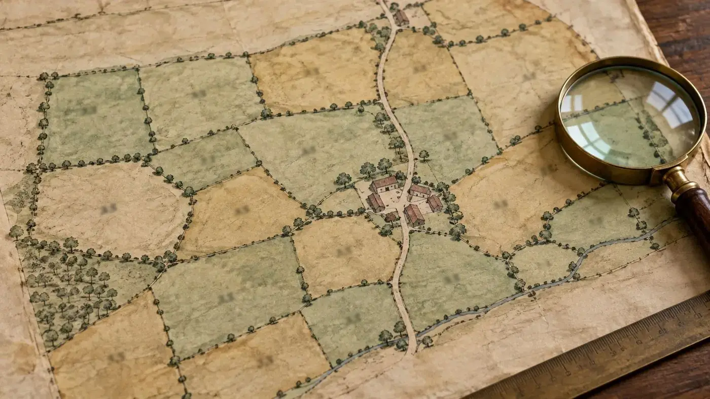
The map is a large-scale plan of the parish with field boundaries, buildings, roads, tracks, woods, streams and ponds, and a number on every parcel of land. The numbers are what tie the map to the apportionment. The map itself hardly ever names anybody.
A few things to watch for:
- First-class and second-class maps. A map that met the Commissioners' standard of accuracy was sealed as first-class and can be relied on as a legal survey. Most are second-class, still useful but sometimes copied from older estate maps and less exact. The seal tells you which you are looking at.
- Scale and orientation. Scales differ, and north is not always at the top, so find the compass point before you compare it with a modern map.
- Buildings. Houses are often coloured one way and farm buildings another, although there was no fixed convention. The church is usually easy to spot and makes a handy fixed point.
- Tithe-free land. Land that was exempt, or whose tithes had already been merged, may have no number or be drawn differently. Leaving it out of the apportionment does not mean nothing was there.
Reading the apportionment
The apportionment is the written schedule. It generally starts with a preamble setting out the agreement or award, the total rent-charge for the parish and who was to receive it. Then comes the schedule in ruled columns, normally grouped by landowner, then occupier, then plot. Many end with a summary giving each owner's and occupier's total acreage and rent-charge.
The columns and what they mean
| Column | What it records | How to use it |
|---|---|---|
| Landowners | The owner of each plot, whether an individual, an institution or trustees | Identifies estates; follow up in estate papers, wills and land tax returns |
| Occupiers | The person actually farming or living on the plot, often a tenant | Links families to farms and cottages; compare with the census of 1841 or 1851 |
| Numbers referring to the plan | The plot number shown on the tithe map | The link between schedule and map |
| Name and description of lands and premises | Field names, or descriptions such as cottage and garden, homestead, or plantation | Good material for landscape and place-name history |
| State of cultivation | Land use: arable, meadow, pasture, wood, coppice, hops and so on | Shows the farming pattern of the parish around 1840 |
| Quantities in statute measure | Area in acres, roods and perches (A R P) | 40 perches make a rood and 4 roods an acre |
| Amount of rent-charge apportioned | The annual sum, in pounds, shillings and pence, payable for the plot | Shows relative value; a large charge on a small plot can mean good land |
| Remarks | Occasional notes, such as exemptions or to whom the charge was payable | Often blank, but always read it |
How to cross-reference plot numbers
Neither document means much without the other. This is the method we would suggest:
- Start with what you already know. For a family, find the name in the occupiers column. For a building or field, find it on the map.
- Write down every plot number against that name, with the field name, acreage and use.
- Find each number on the map. It is usually written inside the plot, sometimes with a small brace pointing into a narrow strip. Numbering tends to run in order across a farm or one part of the parish, so numbers close together in the list are usually close together on the ground.
- Shade or list the plots on a tracing or a copy so that you can see the shape of the holding. Some farms sit tidily round the farmhouse; others are scattered all over the parish.
- Compare the map with later Ordnance Survey maps to find the fields today. The first edition 25-inch and 6-inch maps of the 1870s are the most useful, as field boundaries had often not changed by then.
- Check the summary at the end of the apportionment in case you have missed a plot held by the same person.
If a plot was later split, look for an altered apportionment. These were drawn up when land was sold, divided or built on, and can carry the history of a field on well into the twentieth century.
Using field names for landscape history
For many people the field names are the best part of an apportionment. They keep words that have mostly dropped out of use, and often say something about the land from long before 1840. Interpretations should be treated as ideas to test, not settled answers, but some patterns come up again and again:
- Size and shape: Long Field, Ten Acres, Picked Piece (pointed) or Gore (a triangular plot).
- Former open fields: names with Field, Furlong, Shot or Lands may point to strips of a medieval common field that was later enclosed.
- Woodland clearance: Stocking, Assart, Breach or Ridding often suggest land taken in from wood or waste.
- Soil and character: Flinty, Stony, Clay, Chalk Pit, Sour or Starve-all describe the ground, and in chalk country like this part of Hampshire they are often very apt.
- Ownership and use: Glebe, Parsonage, Church or Clerk's names may mean land belonging to the living. Pound, Kiln, Pit, Warren and Butts record things and activities that have gone.
- People: a personal name on a field may be that of an earlier owner or tenant, sometimes generations before the survey.
Set the tithe names against earlier estate maps, glebe terriers and manorial surveys, where any survive, and you can see how long a name had been in use. Set them against today's names and you see what has been lost.
Using the Steventon award
When you open the Steventon tithe award, read the preamble first for the date of the award and who was entitled to the rent-charge. Run down the landowners column to see how the parish was shared between estates, and the occupiers column to count the separate farms and cottages. Then pick one farm and trace its plots on the map. It does not take long to get a sense of the parish as it was about a generation after Jane Austen left Steventon in 1801.
The award is best read with the society's pages on Steventon village, the photographs on the Steventon images page, and the 1841 and 1851 censuses, where many of the same occupiers turn up.
Limitations to keep in mind
- The survey was about land for tithe purposes and nothing else. Cottagers renting a room, lodgers, and labourers living in at a farmhouse are not in it.
- The occupier is not necessarily the person who lived there. A farmer may be shown as occupying cottages he sublet.
- Surveyors took field names down from whoever they asked locally, so spellings may be phonetic or muddled.
- Map and schedule were made at one date. If anything changed before the award was confirmed, the two may not quite agree.
Frequently asked questions
What is the difference between a tithe map and a tithe apportionment?
The map is a plan of the parish with every parcel of land numbered. The apportionment is the written schedule giving, for each number, the owner, occupier, field name, state of cultivation, area and rent-charge. Each is of little use without the other.
Where can I see the Steventon tithe award?
There is a PDF copy on this site at /assets/images/steventon-tithe-award.pdf. Hampshire tithe records are also held at Hampshire Archives and Local Studies in Winchester, and at The National Archives in series IR 29 and IR 30.
Why is my ancestor not listed in the apportionment?
Only owners and occupiers of land are named. Labourers, lodgers and many cottage tenants are missing, particularly where a farmer is listed as occupier of the cottages. The 1841 and 1851 censuses are the best sources to use alongside it.
What do A, R and P mean?
Acres, roods and perches, the units of area. There are 40 perches to a rood and 4 roods to an acre, so 2 1 20 means 2 acres, 1 rood and 20 perches, or about 2.375 acres.
Does a tithe map show every building?
Most houses and farm buildings are shown, but small structures may be left off, and second-class maps can be less accurate. Check against early Ordnance Survey maps before drawing firm conclusions.
When did tithe rent-charge end?
The Tithe Act 1936 abolished it and put redemption annuities, payable to the state, in its place. Those annuities were ended under the Finance Act 1977, and the last payments fell due in the 1990s.
Further reading on this site
- The Steventon Tithe Map, 1839: every plot transcribed
- How to Trace Your Ancestors from North Waltham, Steventon, Ashe and Deane
- Turnpike Roads and Coaching Inns Around Basingstoke
- A Glossary of Words Found in Old Parish Records
This guide was written for the restored archive by the society's volunteers. If you can add to it or spot a mistake, please get in touch through our contacts page.